Re: [HamWAN PSDR] Portland antenna range help?

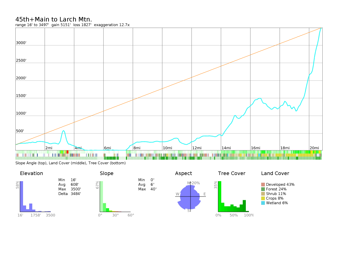
Attached are two elevation plots. • 47th and Hawthorne The high ground blockage for this path is only 1/2 mile away (in the area of 54th and Belmont). • 45th and Main (the "best case" direction) This looks marginal based on ground terrain, and trees may be a problem getting a straight shot. BawFaw Peak, at 73 miles with a sector antenna pointing away from Portland isn't an option. Steve Ted Timmons wrote on 12/30/18 8:15 PM:
er, forgot the heywhatsthat screenshot.
On Sun, Dec 30, 2018 at 8:14 PM Ted Timmons <ted@perljam.net> wrote:
Thanks Ed and Steve- and Herb offlist. I have to use a protected address for mail so that isn't my QTH. I'm within a few blocks of 4700 SE Hawthorne, which (on hamwan.org) shows as being on the fringe of line-of-sight, hence the need for an onsite test. (see screenshot below). I've also mapped it on heywhatsthat (thanks Ed!), which is promising.
I just don't think we can know for sure without testing it.
Herb- elevation of BawFaw is listed on the Oregon page: http://www.oregonhamwan.com/cell-site-hardware/
On Sun, Dec 30, 2018 at 7:23 PM Steve - WA7PTM <psdr-list@aberle.net> wrote:
Is your station location somewhere other than on your license?
Assuming you can get an antenna on the roof, the terrain looks like a straight shot (using CalTopo), but what it doesn't show are the heights of surrounding buildings.
Steve
Ted Timmons wrote on 12/30/18 5:22 PM:
Hey, is there anyone that is available to check reception at my house, or is there a way I can do it with simple equipment? I'm at risk of being in the shadow of Mt. Tabor. _______________________________________________ PSDR mailing list PSDR@hamwan.org http://mail.hamwan.net/mailman/listinfo/psdr

Eddie, Darcy, and Steve, thank you for your replies. Herb
On Dec 31, 2018, at 4:00 AM, Steve - WA7PTM <psdr-list@aberle.net> wrote:
Attached are two elevation plots.
• 47th and Hawthorne The high ground blockage for this path is only 1/2 mile away (in the area of 54th and Belmont).
• 45th and Main (the "best case" direction) This looks marginal based on ground terrain, and trees may be a problem getting a straight shot.
BawFaw Peak, at 73 miles with a sector antenna pointing away from Portland isn't an option.
Steve
Ted Timmons wrote on 12/30/18 8:15 PM:
er, forgot the heywhatsthat screenshot. On Sun, Dec 30, 2018 at 8:14 PM Ted Timmons <ted@perljam.net> wrote:
Thanks Ed and Steve- and Herb offlist. I have to use a protected address for mail so that isn't my QTH. I'm within a few blocks of 4700 SE Hawthorne, which (on hamwan.org) shows as being on the fringe of line-of-sight, hence the need for an onsite test. (see screenshot below). I've also mapped it on heywhatsthat (thanks Ed!), which is promising.
I just don't think we can know for sure without testing it.
Herb- elevation of BawFaw is listed on the Oregon page: http://www.oregonhamwan.com/cell-site-hardware/
On Sun, Dec 30, 2018 at 7:23 PM Steve - WA7PTM <psdr-list@aberle.net> wrote:
Is your station location somewhere other than on your license?
Assuming you can get an antenna on the roof, the terrain looks like a straight shot (using CalTopo), but what it doesn't show are the heights of surrounding buildings.
Steve
Ted Timmons wrote on 12/30/18 5:22 PM:
Hey, is there anyone that is available to check reception at my house, or is there a way I can do it with simple equipment? I'm at risk of being in the shadow of Mt. Tabor. _______________________________________________ PSDR mailing list PSDR@hamwan.org http://mail.hamwan.net/mailman/listinfo/psdr
<47th+Hawthorne-to-Larch-Mtn.png><45th+Main-to-Larch-Mtn.png>_______________________________________________ PSDR mailing list PSDR@hamwan.org http://mail.hamwan.net/mailman/listinfo/psdr
participants (2)
-
 Herb Weiner
 -
 Steve - WA7PTM